Log in
All resources
Create a design
778 Free Artworks of 1870 Maps
gemeente atlas van nederland - south holland
1860s maps of south holland
gemeente atlas van nederland - north holland
1860s maps of north holland
maps from the mechanical curator collection
den danske hærs historie til nutiden og den norske hærs historie indtil 1814
19th-century maps of rotterdam
hoeksche waard in the 19th century
krimpenerwaard in the 19th century
maps of polders in south holland
den danske hærs historie til nutiden og den norske hærs historie indtil 1814
maps from the mechanical curator collection
den danske hærs historie til nutiden og den norske hærs historie indtil 1814
maps from the mechanical curator collection
19th-century maps of the black sea
1870s maps of the caucasus
gemeente atlas van nederland - south holland
1860s maps of south holland
gemeente atlas van nederland - south holland
1860s maps of south holland
gemeente atlas van nederland - south holland
1860s maps of south holland
gemeente atlas van nederland - south holland
1860s maps of south holland
gemeente atlas van nederland - south holland
1860s maps of south holland
gemeente atlas van nederland - south holland
1860s maps of south holland
gemeente atlas van nederland - south holland
1860s maps of south holland
gemeente atlas van nederland - south holland
1860s maps of south holland
gemeente atlas van nederland - south holland
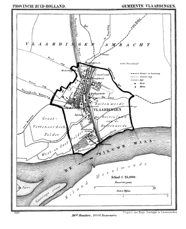
old maps of vlaardingen
den danske hærs historie til nutiden og den norske hærs historie indtil 1814
maps from the mechanical curator collection
maps from the mechanical curator collection available to georeference
maps from the mechanical curator collection
gemeente atlas van nederland - north holland
old maps of haarlem
19th-century maps of russia
russia in the 1860s
gemeente atlas van nederland - north holland
amsterdam in the 1860s
gemeente atlas van nederland - south holland
1860s maps of south holland
gemeente atlas van nederland - south holland
1860s maps of south holland
gemeente atlas van nederland - north holland
19th-century maps of amsterdam
gemeente atlas van nederland - south holland
maps of stompwijk
19th-century maps of the black sea
1870s maps of the caucasus
gemeente atlas van nederland - south holland
1860s maps of south holland
maps of paris from bibliothèque nationale de france
1870s maps of paris
gemeente atlas van nederland - south holland
strevelshoek
gemeente atlas van nederland - south holland
19th-century maps of rotterdam
gemeente atlas van nederland - south holland
1860s maps of south holland
gemeente atlas van nederland - south holland
maps of heerjansdam
gemeente atlas van nederland - south holland
1860s maps of south holland
gemeente atlas van nederland - south holland
maps of geervliet
gemeente atlas van nederland - south holland
1860s maps of south holland
gemeente atlas van nederland - south holland
1860s maps of south holland
gemeente atlas van nederland - south holland
1860s maps of south holland
gemeente atlas van nederland - south holland
maps of hendrik-ido-ambacht
gemeente atlas van nederland - south holland
1860s maps of south holland
gemeente atlas van nederland - south holland
1860s maps of south holland
gemeente atlas van nederland - north holland
1860s maps of north holland
old maps of são paulo (city)
maps of são paulo (city)
gemeente atlas van nederland - south holland
maps of haastrecht
gemeente atlas van nederland - south holland
1860s maps of south holland
gemeente atlas van nederland - south holland
maps of ameide
gemeente atlas van nederland - south holland
1860s maps of south holland
maps from the mechanical curator collection available to georeference
maps from the mechanical curator collection
gemeente atlas van nederland - south holland
old maps of eiland van dordrecht
maps by takeshiro matsuura
maps of the kuril islands
gemeente atlas van nederland - north holland
maps of bergen, north holland
gemeente atlas van nederland - south holland
19th-century maps of rotterdam
gemeente atlas van nederland - south holland
1860s maps of south holland
gemeente atlas van nederland - south holland
1860s maps of south holland
gemeente atlas van nederland - south holland
1860s maps of south holland
old maps of 's-hertogenbosch
empel en meerwijk
19th-century maps of russia
russia in the 1860s
gemeente atlas van nederland - north holland
19th-century maps of amsterdam
gemeente atlas van nederland - south holland
maps of krimpen aan de lek
gemeente atlas van nederland - south holland
1860s maps of south holland
maps of nieuwpoort, south-holland
vestingwerken nieuwpoort
gemeente atlas van nederland - south holland
1860s maps of south holland
gemeente atlas van nederland - south holland
1860s maps of south holland
gemeente atlas van nederland - south holland
maps of nieuwenhoorn
maps from the earth and its inhabitants, vol. v
maps of railway lines in norway
gemeente atlas van nederland - south holland
maps of waddinxveen
gemeente atlas van nederland - south holland
giessen (river south-holland)
maps of nieuw-helvoet
nieuw-helvoet
gemeente atlas van nederland - north holland
old maps of amsterdam
gemeente atlas van nederland - south holland
1860s maps of south holland
gemeente atlas van nederland - south holland
1860s maps of south holland
gemeente atlas van nederland - south holland
giessen (river south-holland)
maps from the mechanical curator collection available to georeference
maps from the mechanical curator collection
gemeente atlas van nederland - south holland
old maps of brielle
gemeente atlas van nederland - south holland
19th-century maps of rotterdam
maps of polders in zeeland
maps of terneuzen
gemeente atlas van nederland - south holland
1860s maps of south holland
gemeente atlas van nederland - south holland
old maps of the hague
gemeente atlas van nederland - south holland
19th-century maps of rotterdam
gemeente atlas van nederland - south holland
19th-century maps of rotterdam
gemeente atlas van nederland - south holland
1860s maps of south holland
gemeente atlas van nederland - north holland
old maps of alkmaar
gemeente atlas van nederland - south holland
19th-century maps of rotterdam
den danske hærs historie til nutiden og den norske hærs historie indtil 1814
maps from the mechanical curator collection
gemeente atlas van nederland - south holland
1860s maps of south holland
gemeente atlas van nederland - south holland
1860s maps of south holland
gemeente atlas van nederland - south holland
1860s maps of south holland
gemeente atlas van nederland - south holland
1860s maps of south holland
gemeente atlas van nederland - south holland
1860s maps of south holland
gemeente atlas van nederland - south holland
1860s maps of south holland
gemeente atlas van nederland - south holland
maps of zoeterwoude
gemeente atlas van nederland - south holland
maps of zoeterwoude
den danske hærs historie til nutiden og den norske hærs historie indtil 1814
maps from the mechanical curator collection
gemeente atlas van nederland - south holland
maps of lisse
gemeente atlas van nederland - south holland
1860s maps of south holland
gemeente atlas van nederland - north holland
maps of beemster
gemeente atlas van nederland - south holland
maps of zoetermeer
gemeente atlas van nederland - south holland
1860s maps of south holland
gemeente atlas van nederland - south holland
maps of piershil
gemeente atlas van nederland - south holland
maps of goudswaard
gemeente atlas van nederland - south holland
old maps of gouda
gemeente atlas van nederland - south holland
old maps of leiden
gemeente atlas van nederland - south holland
old maps of gouda
gemeente atlas van nederland - south holland
maps of groot-ammers
gemeente atlas van nederland - south holland
maps of zuid-beijerland
101 - 200 of 778
Next page
/ 8